
Raster Layer Support
October 11, 2023
Summary
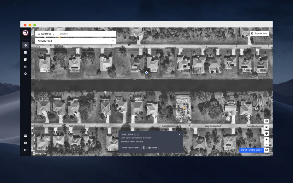
Forerunner can now support raster layers in the platform! Users can now gather ground elevation and flood depth measurements from raster datasets at the property level to better understand and contextualize flood risk.
Sign up for our newsletter!
Receive a monthly update from us with news, product updates, and resources from our team.
Oops! Something went wrong while submitting the form.
Sign up for our newsletter!
Receive a monthly update from us with news, product updates, and resources from our team.
Oops! Something went wrong while submitting the form.
Sign up for our newsletter!
Receive a monthly update from us with news, product updates, and resources from our team.
Oops! Something went wrong while submitting the form.
Download the Whitepaper
Open Whitepaper
Download Whitepaper
Thank you! You can download the whitepaper with the links below:
Download NowDownload NowOops! Something went wrong while submitting the form.
Sign up for our newsletter!
Receive a monthly update from us with news, product updates, and resources from our team.
Oops! Something went wrong while submitting the form.
Sign up for our newsletter!
Receive a monthly update from us with news, product updates, and resources from our team.
Oops! Something went wrong while submitting the form.
FAQ
The FAQ section wont appear on published site if all FAQs are empty
The FAQ section wont appear on published site if all FAQs are empty
The FAQ section wont appear on published site if all FAQs are empty
The FAQ section wont appear on published site if all FAQs are empty
The FAQ section wont appear on published site if all FAQs are empty
The FAQ section wont appear on published site if all FAQs are empty
Ready to see how Forerunner can support your community?
Book a demo