
Forerunner is the geospatial intelligence layer forgovernments and regulated industries.
Unify geospatial data, field operations, and AI-powered workflows in one platform—integrated with your existing systems and built for complex compliance environments.


Corpus Christi

Stockton
California

Sanibel
Florida

Puerto Rico

Preston County
West Virginia

Pompano Beach
Florida

Pitt County
North Carolina

Pensacola
Florida

Panama City
Florida

Old Orchard Beach
Maine
Okaloosa County
Florida
Monroe
Louisiana

Miramar
Florida

Maine BOI

Lewes
Delaware

Hollywood
Florida

Hattiesburg
Mississippi
Hampton
Virginia

Gila County
Arizona

Fort Myers
Florida

Florissant
Missouri

Fairfax
Virginia
DeSoto County
Florida

Dauphin Island
Alabama

Cottage Grove
Oregon

Chatham County
Georgia

Cape Coral
Florida
Ascension Parish
Louisiana

Tangipahoa Parish
Louisiana

Port Arthur
Texas

Lincoln
Nebraska

Leon County
Florida

Lee County
Florida
Monmouth County
New Jersey
Sea Isle City
New Jersey

South Pasadena
Florida
Santa Barbara County
California

FDEM
Florida

Alexandria
Virginia
Terrebone Parish
Louisiana

Concord
California
Norfolk
Virginia

Peterborough
New Hampshire
Escambia County
Florida

Calvert County
Maryland

Wilson County
Tennessee

Key West
Florida
West Palm Beach
Florida

Las Cruces
New Mexico
Naples
Florida

Miami
Florida
Fort Pierce
Florida

Tampa
Florida

Santa Rosa County
Florida

Palm Beach County
Florida

Orting
Washington

Ocean Township
New Jersey

Hoboken
New Jersey

Jefferson Parish
Louisiana

Hialeah
Florida

Harris County
Texas

Georgetown County
South Carolina

Longport
New Jersey

Destin
Florida
Clearwater
Florida

Cape May
New Jersey

Brick
New Jersey

Kitty Hawk
North Carolina

Cedar Rapids
Iowa

Coral Gables
Florida
Corpus Christi
Stockton
California
Sanibel
Florida
Puerto Rico
Preston County
West Virginia
Pompano Beach
Florida
Pitt County
North Carolina
Pensacola
Florida
Panama City
Florida
Old Orchard Beach
Maine
Okaloosa County
Florida
Monroe
Louisiana
Miramar
Florida
Maine BOI
Lewes
Delaware
Hollywood
Florida
Hattiesburg
Mississippi
Hampton
Virginia
Gila County
Arizona
Fort Myers
Florida
Florissant
Missouri
Fairfax
Virginia
DeSoto County
Florida
Dauphin Island
Alabama
Cottage Grove
Oregon
Chatham County
Georgia
Cape Coral
Florida
Ascension Parish
Louisiana
Tangipahoa Parish
Louisiana
Port Arthur
Texas
Lincoln
Nebraska
Leon County
Florida
Lee County
Florida
Monmouth County
New Jersey
Sea Isle City
New Jersey
South Pasadena
Florida
Santa Barbara County
California
FDEM
Florida
Alexandria
Virginia
Terrebone Parish
Louisiana
Concord
California
Norfolk
Virginia
Peterborough
New Hampshire
Escambia County
Florida
Calvert County
Maryland
Wilson County
Tennessee
Key West
Florida
West Palm Beach
Florida
Las Cruces
New Mexico
Naples
Florida
Miami
Florida
Fort Pierce
Florida
Tampa
Florida
Santa Rosa County
Florida
Palm Beach County
Florida
Orting
Washington
Ocean Township
New Jersey
Hoboken
New Jersey
Jefferson Parish
Louisiana
Hialeah
Florida
Harris County
Texas
Georgetown County
South Carolina
Longport
New Jersey
Destin
Florida
Clearwater
Florida
Cape May
New Jersey
Brick
New Jersey
Kitty Hawk
North Carolina
Cedar Rapids
Iowa
Coral Gables
Florida
Connected systems.
Guided fieldwork.
Automated action.
The agencies and operators responsible for critical infrastructure spend millions on systems that still can’t talk to each other — while field crews’ most valuable observations fall through the cracks. Forerunner is the AI-powered intelligence layer that sits on top of the stack you already have, fills the gap your systems can’t, and turns fragmented data into the decisions and actions that reduce liability, surface revenue, and prevent issues from becoming emergencies.

Connect your systems.

Guide your team.

Turn data into answers.

Close the loop.
Built for the teams responsible for the built environment.


One platform.
Every layer of your operation.
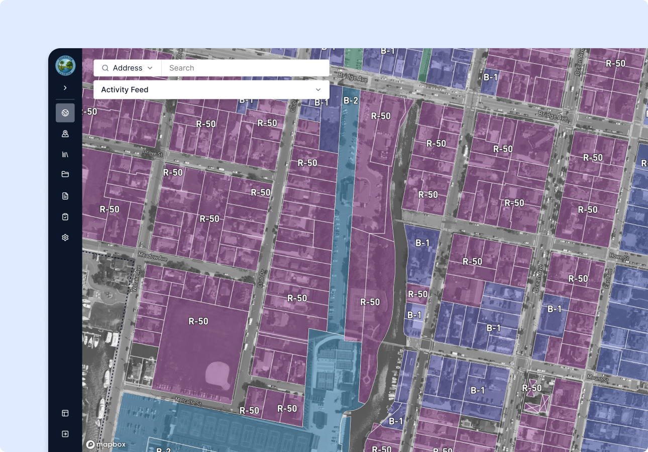
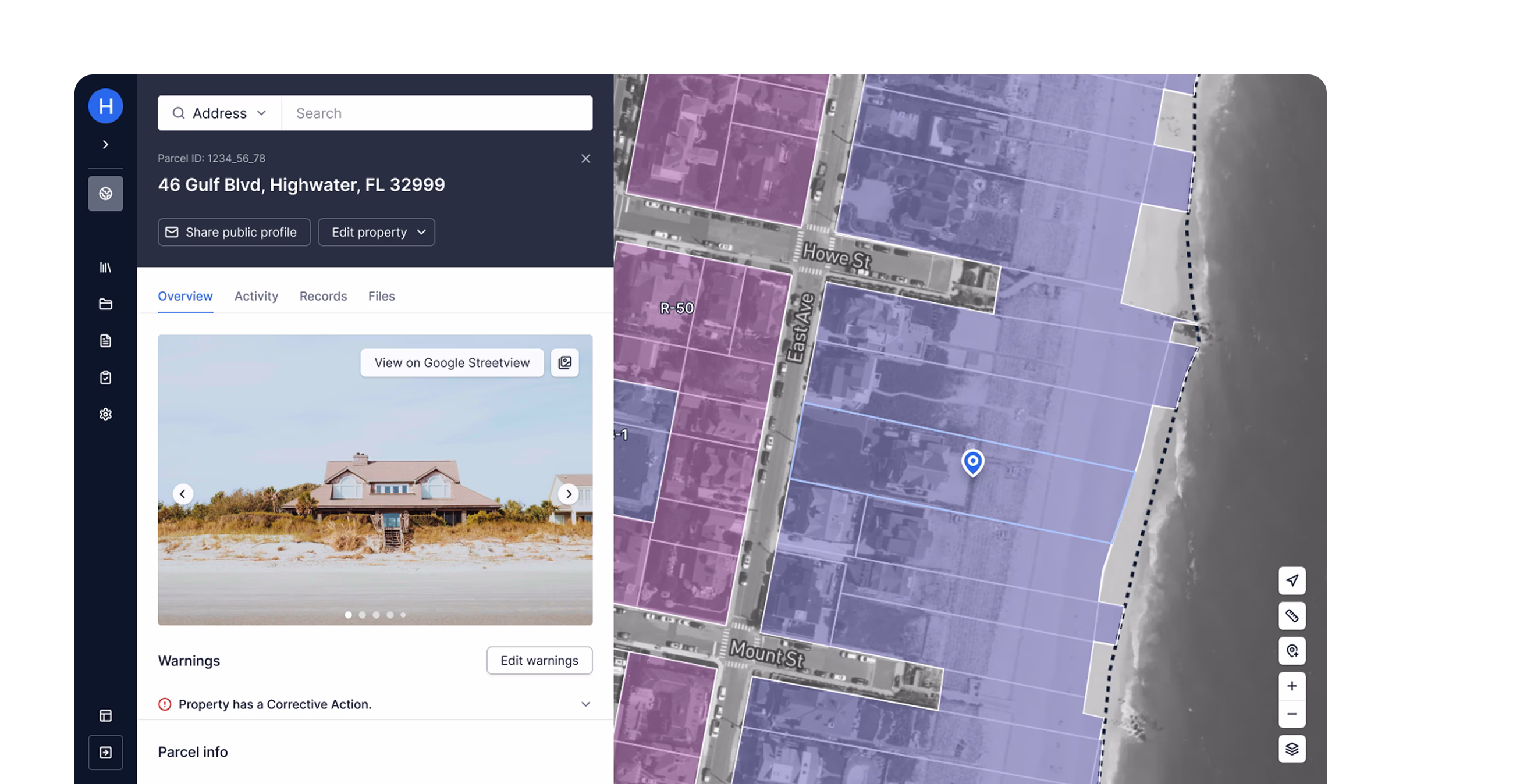
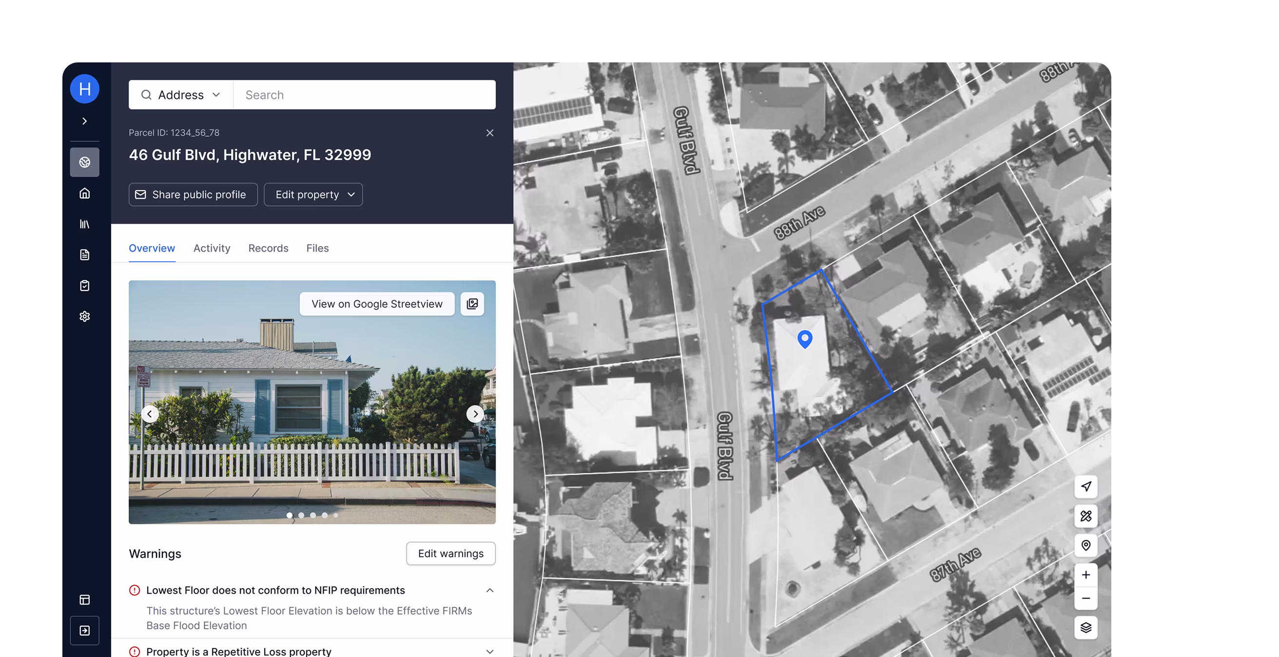
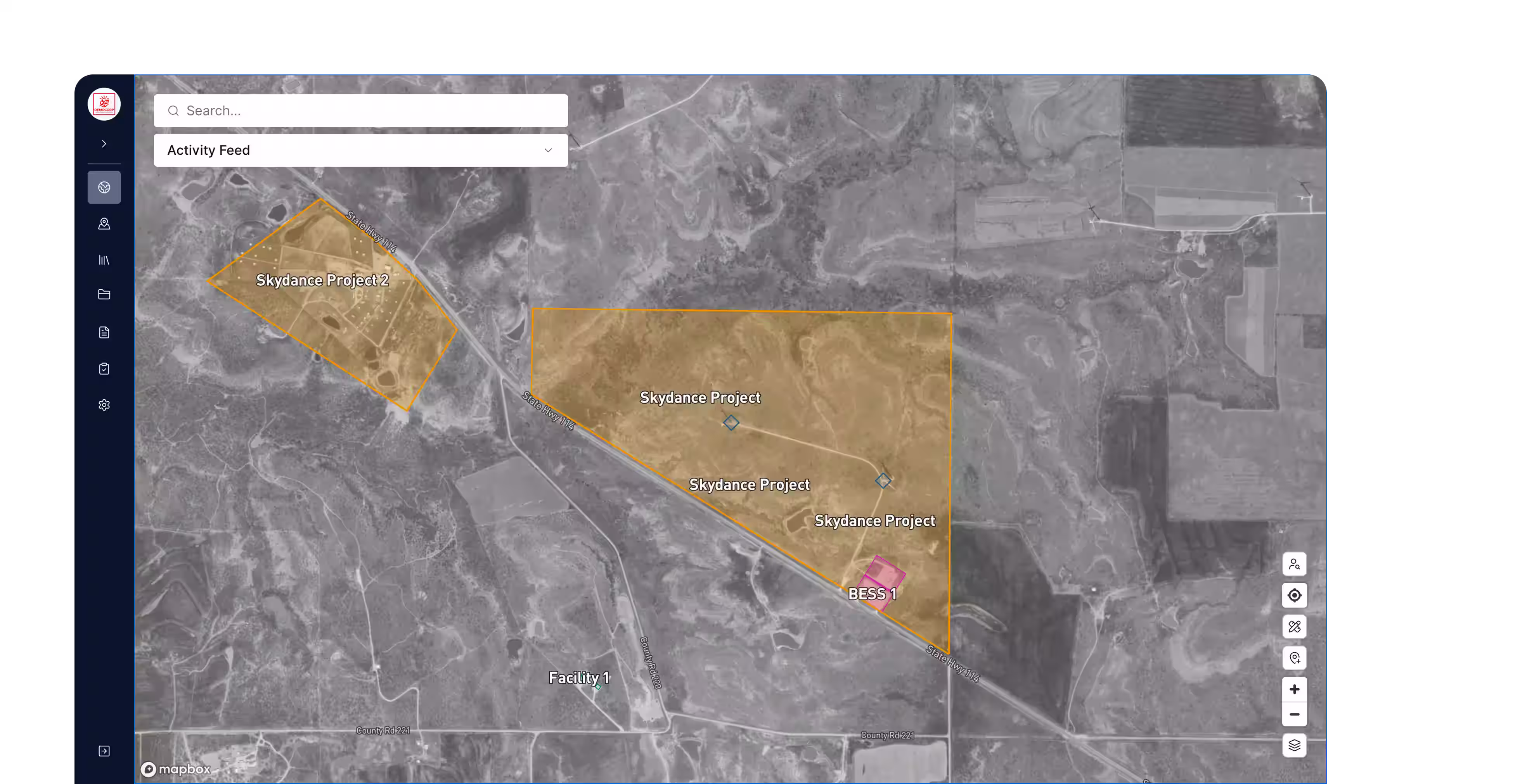
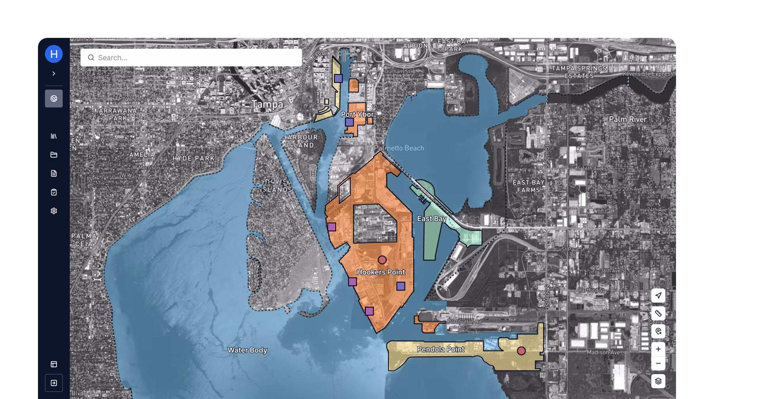
Geospatial intelligence.
A map-first foundation that puts every asset, permit parcel, violation, and environmental layer in one place — with satellite imagery, custom overlays, and the geographic context your team needs to make decisions.
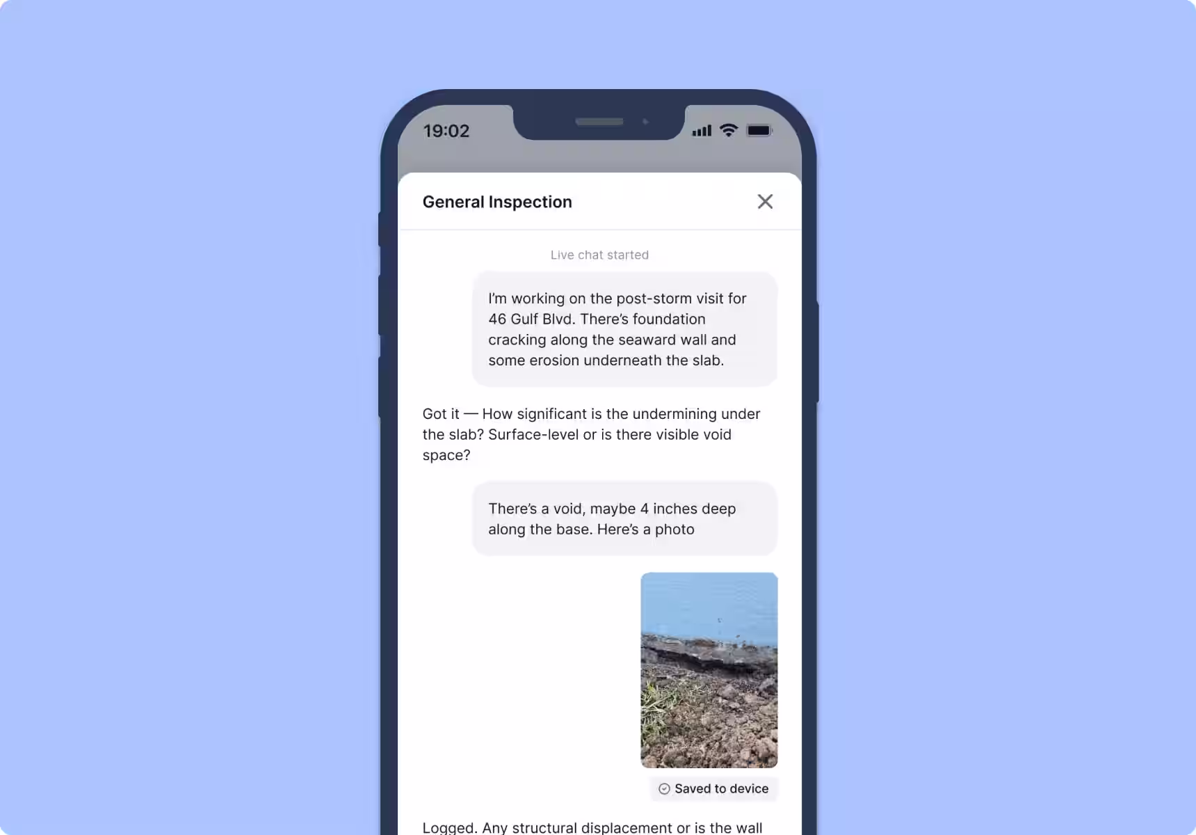
AI-guided field operations.
Configurable workflows for inspections, permits, violations, and grant tracking — with offline-capable mobile tools, AI that fills records automatically, and community-facing portals that keep residents and applications in the loop.
Automated workflows and reporting.
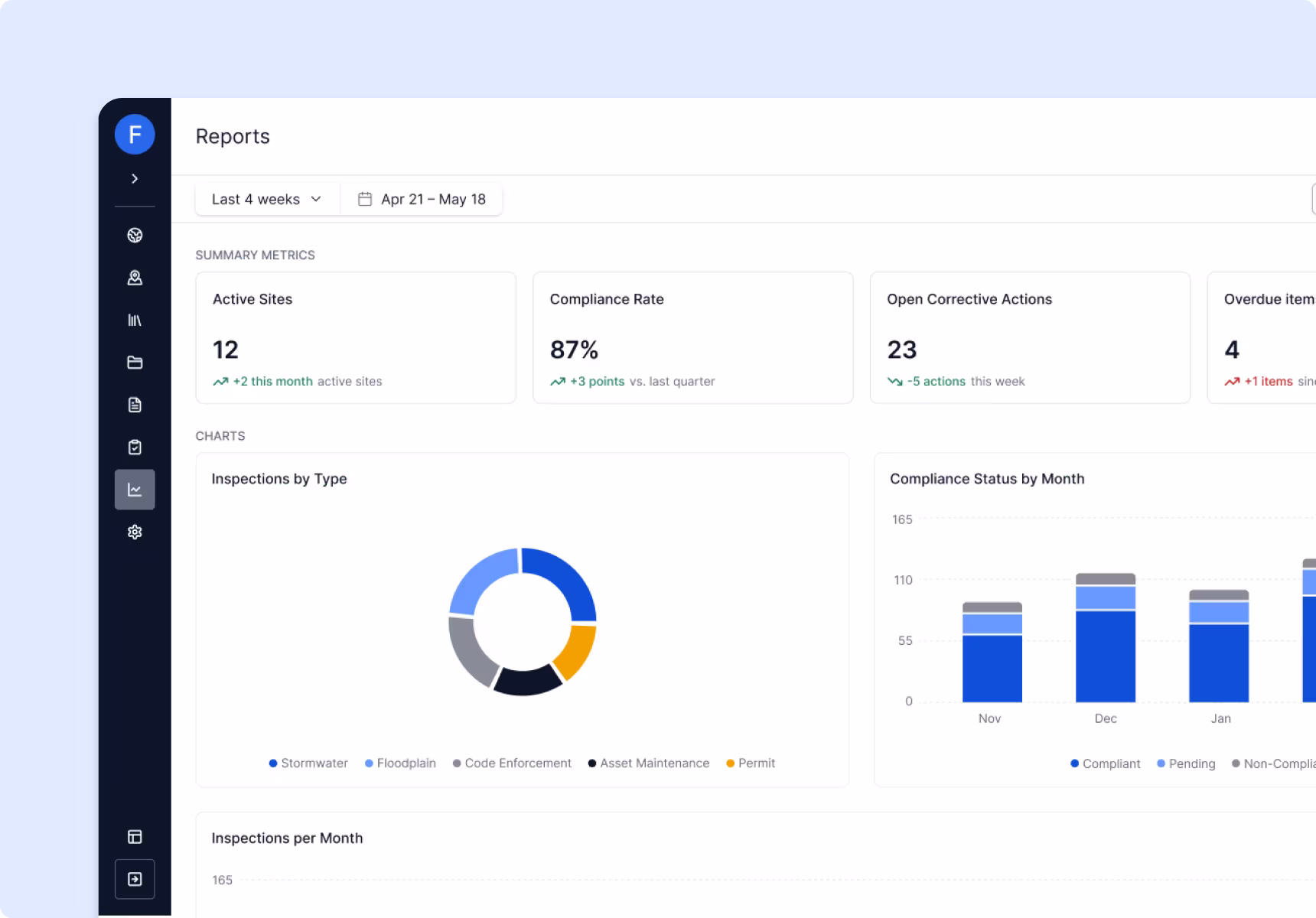
Inspection findings generate corrective actions. Permit deadlines trigger notifications. Grant milestones route to the right owner. Regulatory reports pull from live data automatically. Forerunner closes the loop so your team doesn’t have to chase it down.
Built differently — by design.

We work with what you have.
Your GIS shows what’s in the record. Your field tools capture what crews log into them. But neither gives you the full picture. Forerunner bridges both — and connects everything to the systems your team already uses.

We close the loop with action.
Most tools stop at insight. Forerunner routes work to the right person, triggers updates in connected systems, and handles the follow-through so nothing falls through the cracks.

We deploy in weeks.
Because we don’t ask you to rip out what you have, you’re up and running in weeks — not the 12 to 24 months you’d spend on a full platform replacement.
Powering communities
across the country.


Santa Rosa County accelerated disaster response when every second mattered.

Walton County simplified workflows to reduce administrative burden.
Ready to see Forerunner in action?
Book a demo