An intelligent platform formodern floodplain programs.
AI-powered tools that connect flood risk data, permitting, and compliance—helping teams manage floodplain programs with clarity and confidence.
Corpus Christi
Stockton
California
Sanibel
Florida

Puerto Rico

Preston County
West Virginia

Pompano Beach
Florida

Pitt County
North Carolina
Pensacola
Florida
Panama City
Florida

Old Orchard Beach
Maine
Okaloosa County
Florida
Monroe
Louisiana

Miramar
Florida
Maine BOI

Lewes
Delaware

Hollywood
Florida
Hattiesburg
Mississippi
Hampton
Virginia
Gila County
Arizona
Fort Myers
Florida
Florissant
Missouri

Fairfax
Virginia
DeSoto County
Florida

Dauphin Island
Alabama

Cottage Grove
Oregon

Chatham County
Georgia

Cape Coral
Florida
Ascension Parish
Louisiana
Tangipahoa Parish
Louisiana

Port Arthur
Texas

Lincoln
Nebraska
Leon County
Florida
Lee County
Florida
Monmouth County
New Jersey
Sea Isle City
New Jersey
South Pasadena
Florida
Santa Barbara County
California
FDEM
Florida
Alexandria
Virginia
Terrebone Parish
Louisiana

Concord
California
Norfolk
Virginia

Peterborough
New Hampshire
Escambia County
Florida
Calvert County
Maryland

Wilson County
Tennessee

Key West
Florida
West Palm Beach
Florida

Las Cruces
New Mexico
Naples
Florida
Miami
Florida
Fort Pierce
Florida

Tampa
Florida

Santa Rosa County
Florida

Palm Beach County
Florida

Orting
Washington

Ocean Township
New Jersey

Hoboken
New Jersey

Jefferson Parish
Louisiana

Hialeah
Florida

Harris County
Texas

Georgetown County
South Carolina

Longport
New Jersey

Destin
Florida
Clearwater
Florida

Cape May
New Jersey

Brick
New Jersey

Kitty Hawk
North Carolina

Cedar Rapids
Iowa

Coral Gables
Florida
Corpus Christi
Stockton
California
Sanibel
Florida
Puerto Rico
Preston County
West Virginia
Pompano Beach
Florida
Pitt County
North Carolina
Pensacola
Florida
Panama City
Florida
Old Orchard Beach
Maine
Okaloosa County
Florida
Monroe
Louisiana
Miramar
Florida
Maine BOI
Lewes
Delaware
Hollywood
Florida
Hattiesburg
Mississippi
Hampton
Virginia
Gila County
Arizona
Fort Myers
Florida
Florissant
Missouri
Fairfax
Virginia
DeSoto County
Florida
Dauphin Island
Alabama
Cottage Grove
Oregon
Chatham County
Georgia
Cape Coral
Florida
Ascension Parish
Louisiana
Tangipahoa Parish
Louisiana
Port Arthur
Texas
Lincoln
Nebraska
Leon County
Florida
Lee County
Florida
Monmouth County
New Jersey
Sea Isle City
New Jersey
South Pasadena
Florida
Santa Barbara County
California
FDEM
Florida
Alexandria
Virginia
Terrebone Parish
Louisiana
Concord
California
Norfolk
Virginia
Peterborough
New Hampshire
Escambia County
Florida
Calvert County
Maryland
Wilson County
Tennessee
Key West
Florida
West Palm Beach
Florida
Las Cruces
New Mexico
Naples
Florida
Miami
Florida
Fort Pierce
Florida
Tampa
Florida
Santa Rosa County
Florida
Palm Beach County
Florida
Orting
Washington
Ocean Township
New Jersey
Hoboken
New Jersey
Jefferson Parish
Louisiana
Hialeah
Florida
Harris County
Texas
Georgetown County
South Carolina
Longport
New Jersey
Destin
Florida
Clearwater
Florida
Cape May
New Jersey
Brick
New Jersey
Kitty Hawk
North Carolina
Cedar Rapids
Iowa
Coral Gables
Florida
Your flood risk operations,

transformed.

Map and analyze flood risks.

Streamline compliance.

Operate efficiently in the field.

Engage and inform your community.
Tools that support compliance and strengthen
floodplain resilience.
Forerunner unifies flood risk data, documents, inspections, and compliance workflows so your team is prepared for anything.
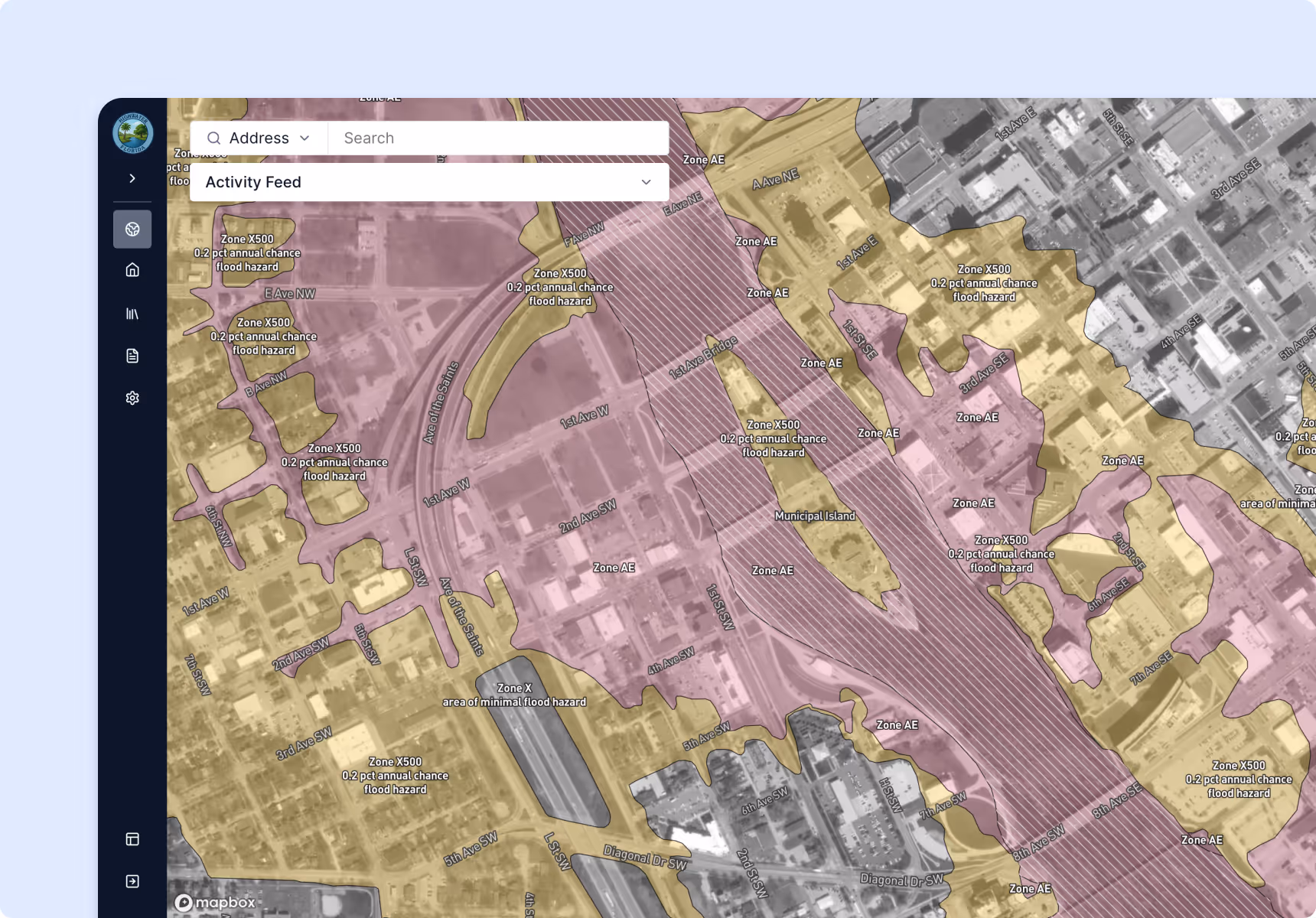
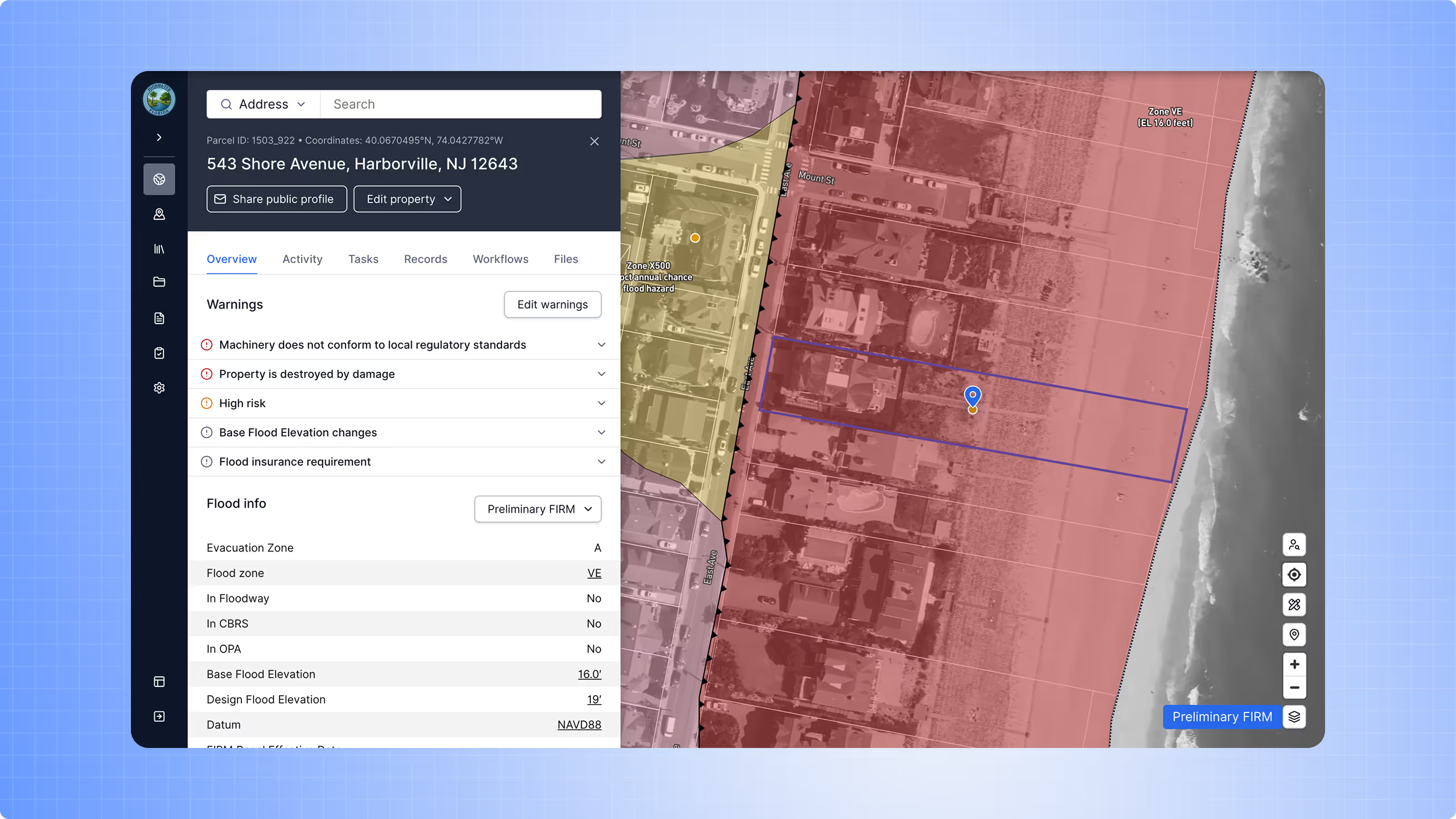
See flood risks at a glance.
Overlay FEMA’s National Flood Hazard Layer (NFHL) with local datasets to quickly understand flood zones, elevation requirements, and risk patterns. Help staff interpret hazard data with intuitive mapping tools.
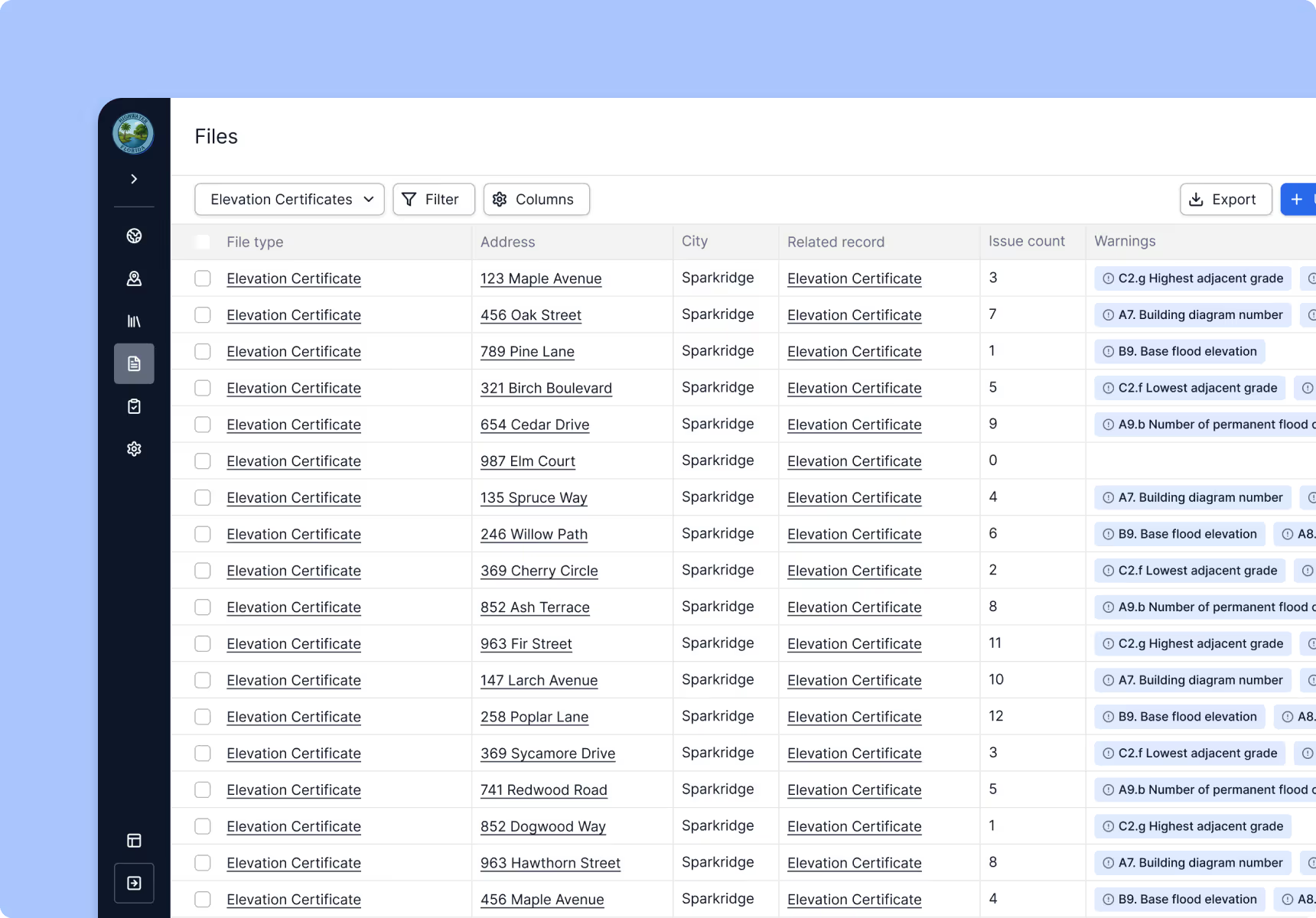
Centralize your floodplain records.
Keep Elevation Certificates, floodproofing documents, Repetitive Loss data, permit files, and Letters of Map Change all in one searchable platform. Stay organized for audits without chasing paper files or scattered PDFs.
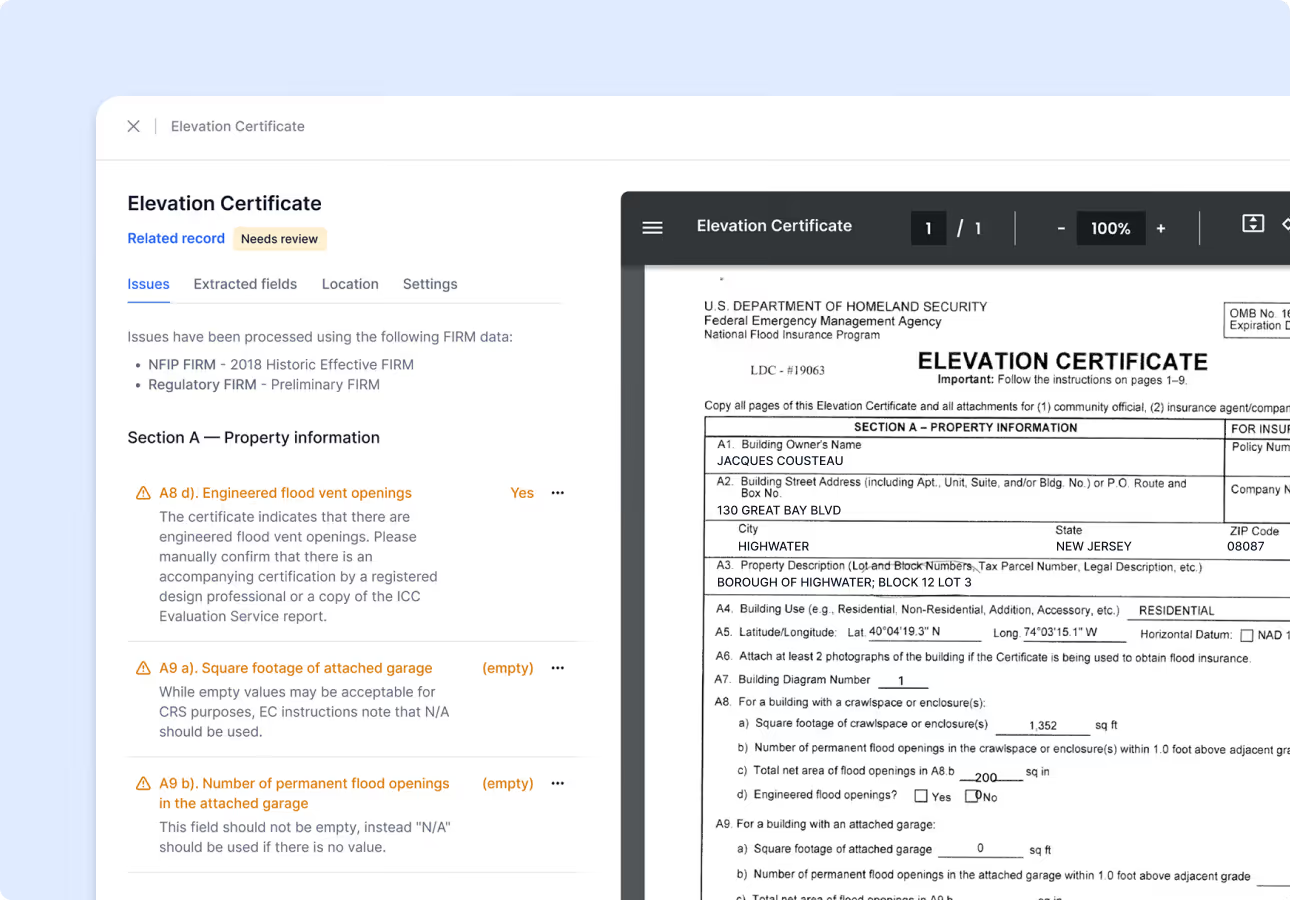
Ensure accuracy with automated checks.
AI-powered validation reviews Elevation Certificates and other key floodplain documents for accuracy. Automatically flag missing fields, inconsistent values, and common errors before they slow down your workflows.
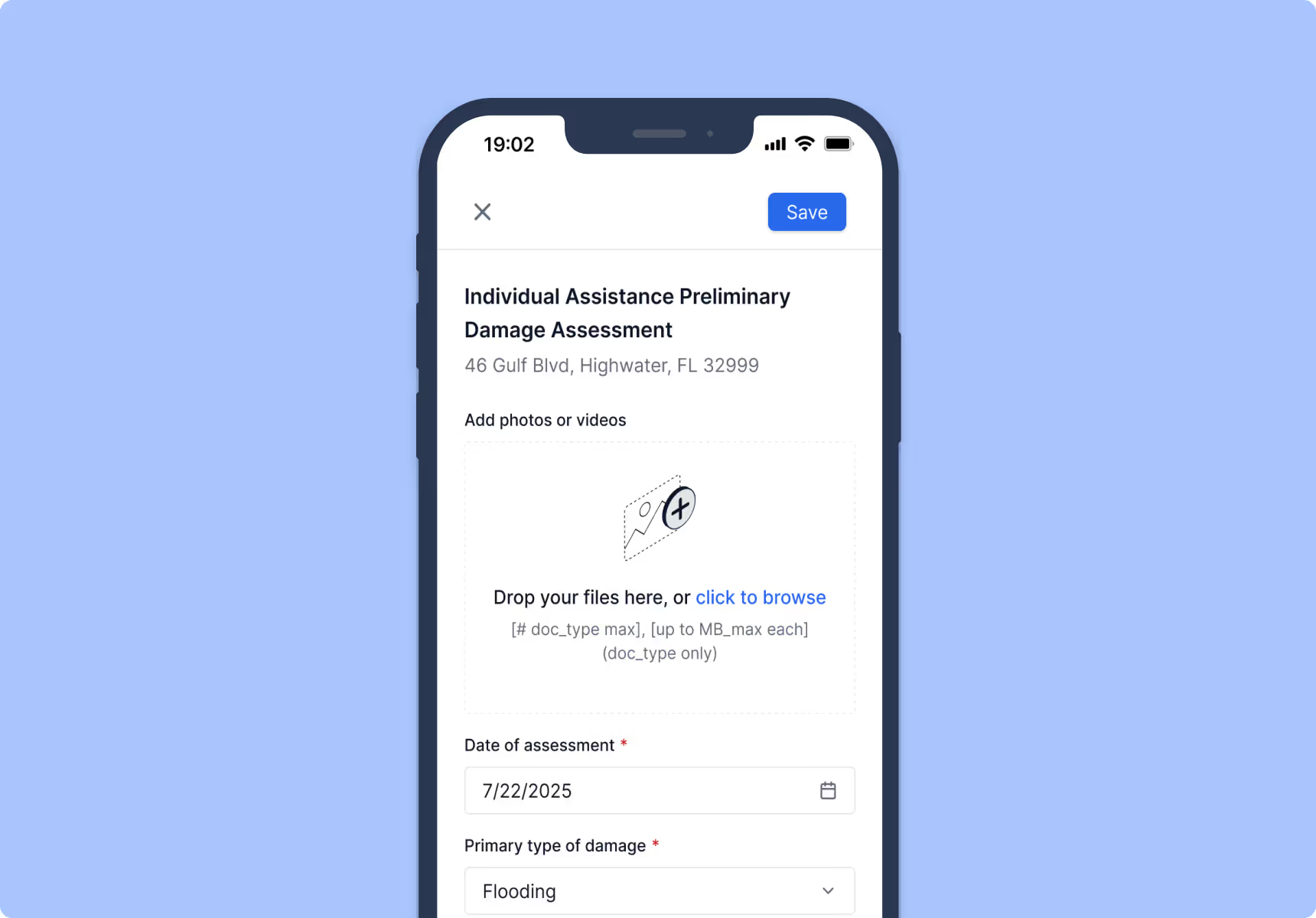
Work from anywhere with mobile inspections.
Capture photos, notes, and inspection data in the field and sync instantly to the platform. Whether conducting post-disaster Substantial Damage assessments or routine permit inspections, mobile tools keep your team aligned and efficient — even offline.
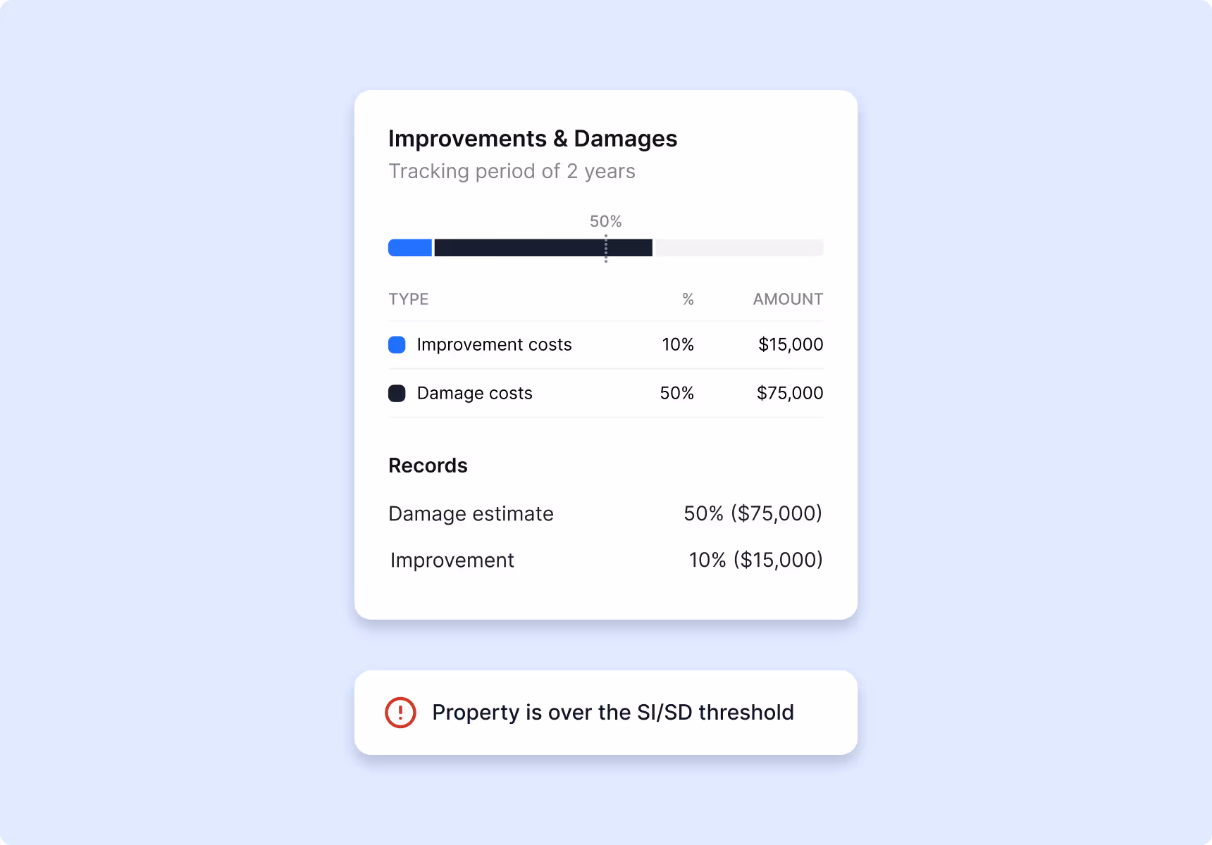
Track SI/SD compliance with ease.
Monitor Substantial Improvement / Substantial Damage values, cumulative improvements, and permit milestones in a single dashboard. Stay ahead of your threshold with automatic alerts and structured workflows.
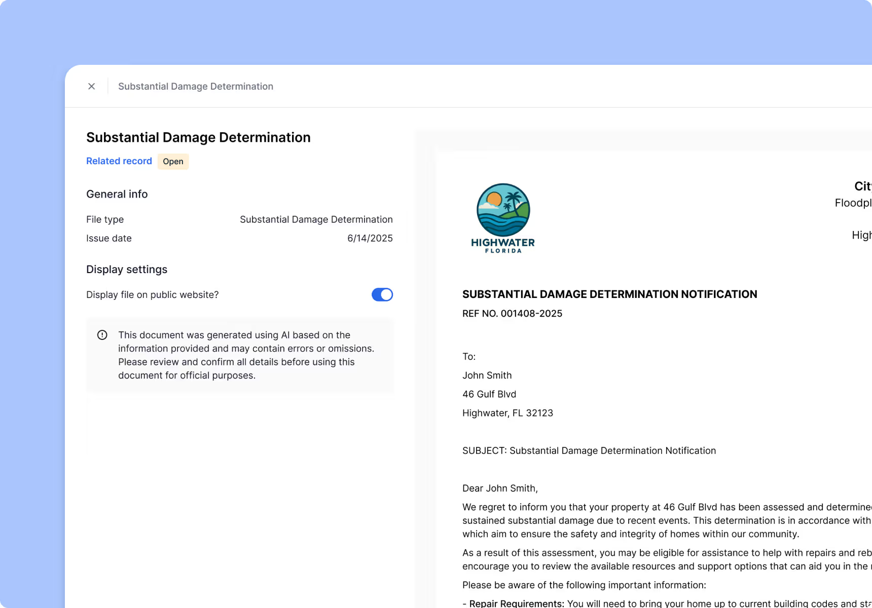
Automate documents and outreach.
Generate consistent permit letters, inspection forms, and Substantial Damage determinations using standardized templates. Use integrated mailing tools to produce and send resident notices at scale.
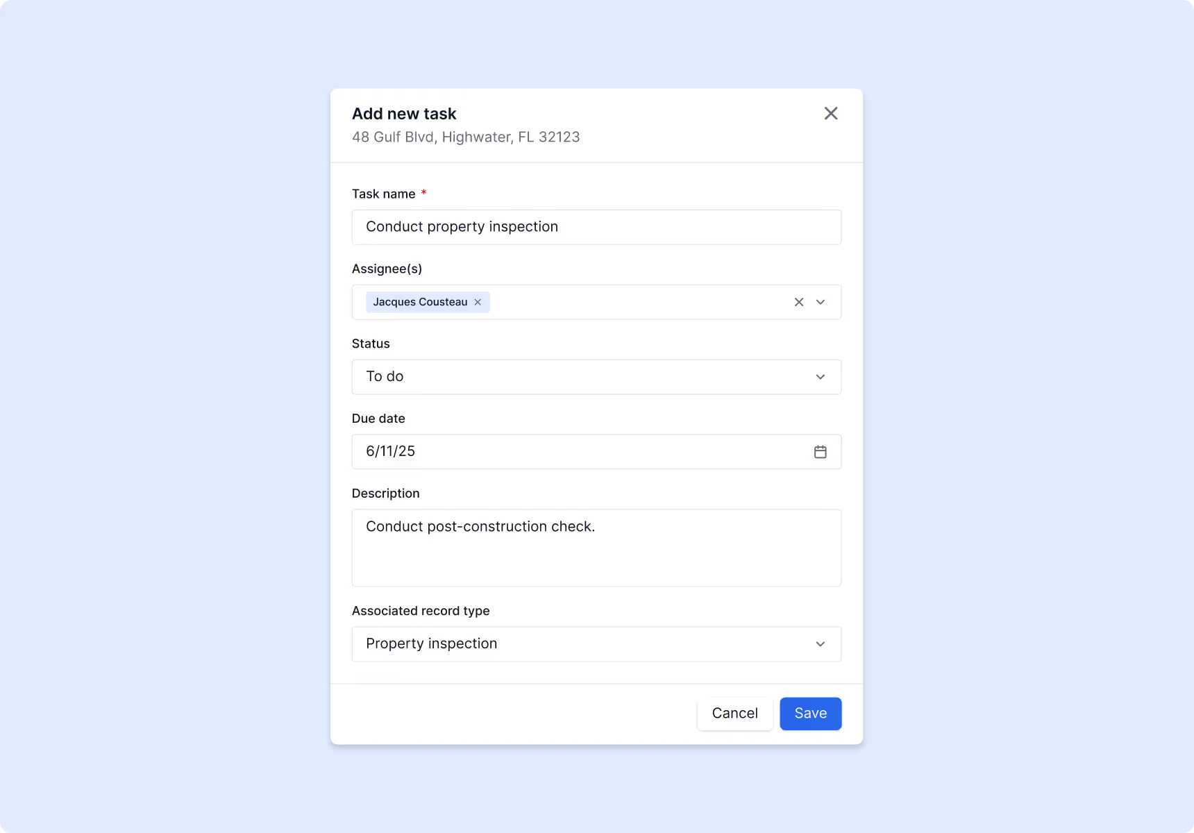
Coordinate workflows across teams.
Standardize permitting, inspections, and follow-up tasks with structured workflows that keep staff aligned and reduce bottlenecks.

Simplify reporting.
Quickly pull documentation, parcel histories, and permits needed for audits. Save hours preparing reports with organized, ready-to-submit records.
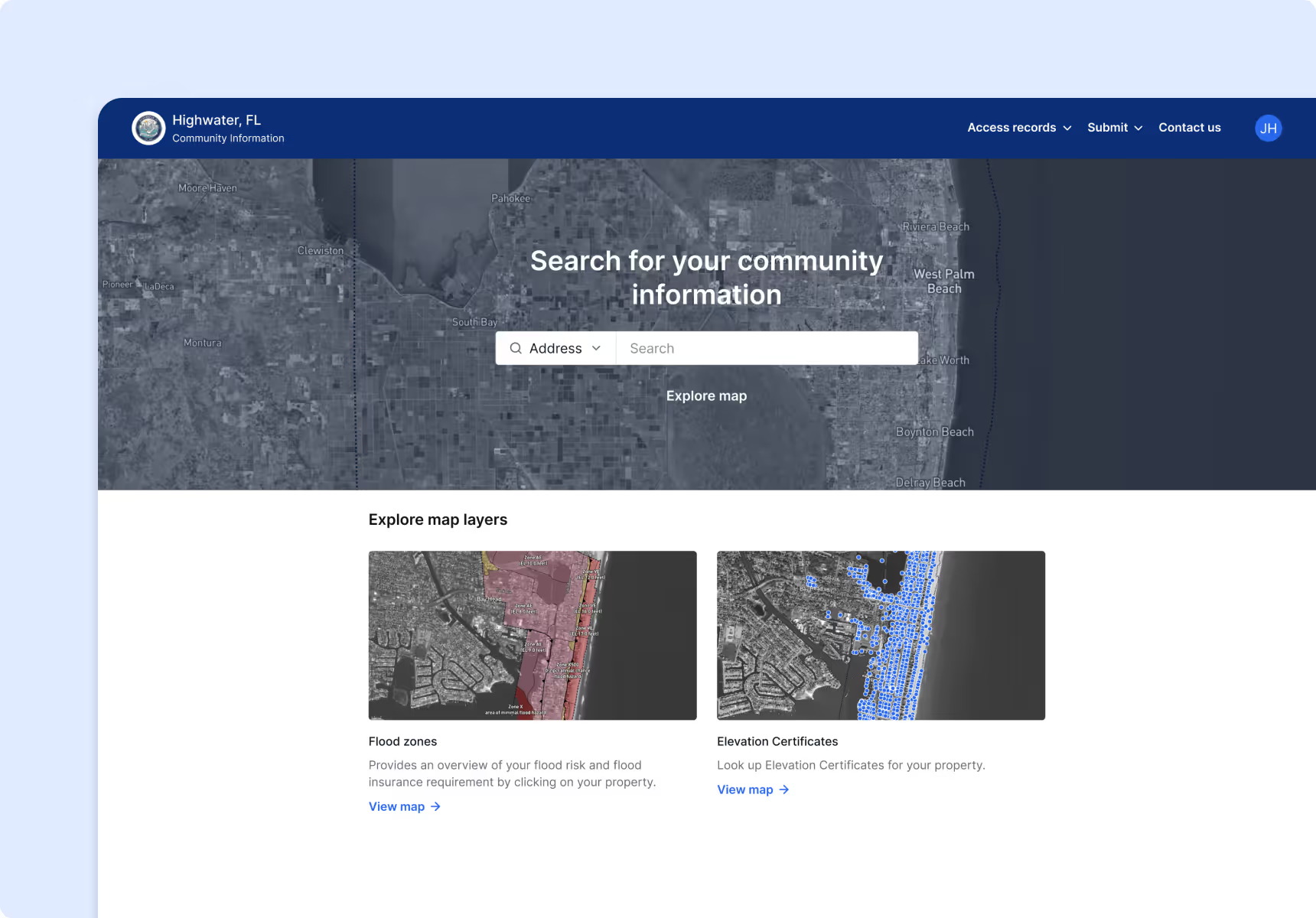
Keep your public informed and prepared.
Deliver clear, accessible flood risk information through a resident-facing portal. Provide flood zone details, historical insights, and mitigation resources that empower homeowners to take action and reduce risk.
Results from the field.


Walton County simplified workflows to reduce administrative burden.
Lee County saves approximately 16 hours of staff time per week, which translates into 832 hours in a year and over 100 working days.

Ready to modernize your floodplain operations?
Book a demo